The High Line vs. the Park Line
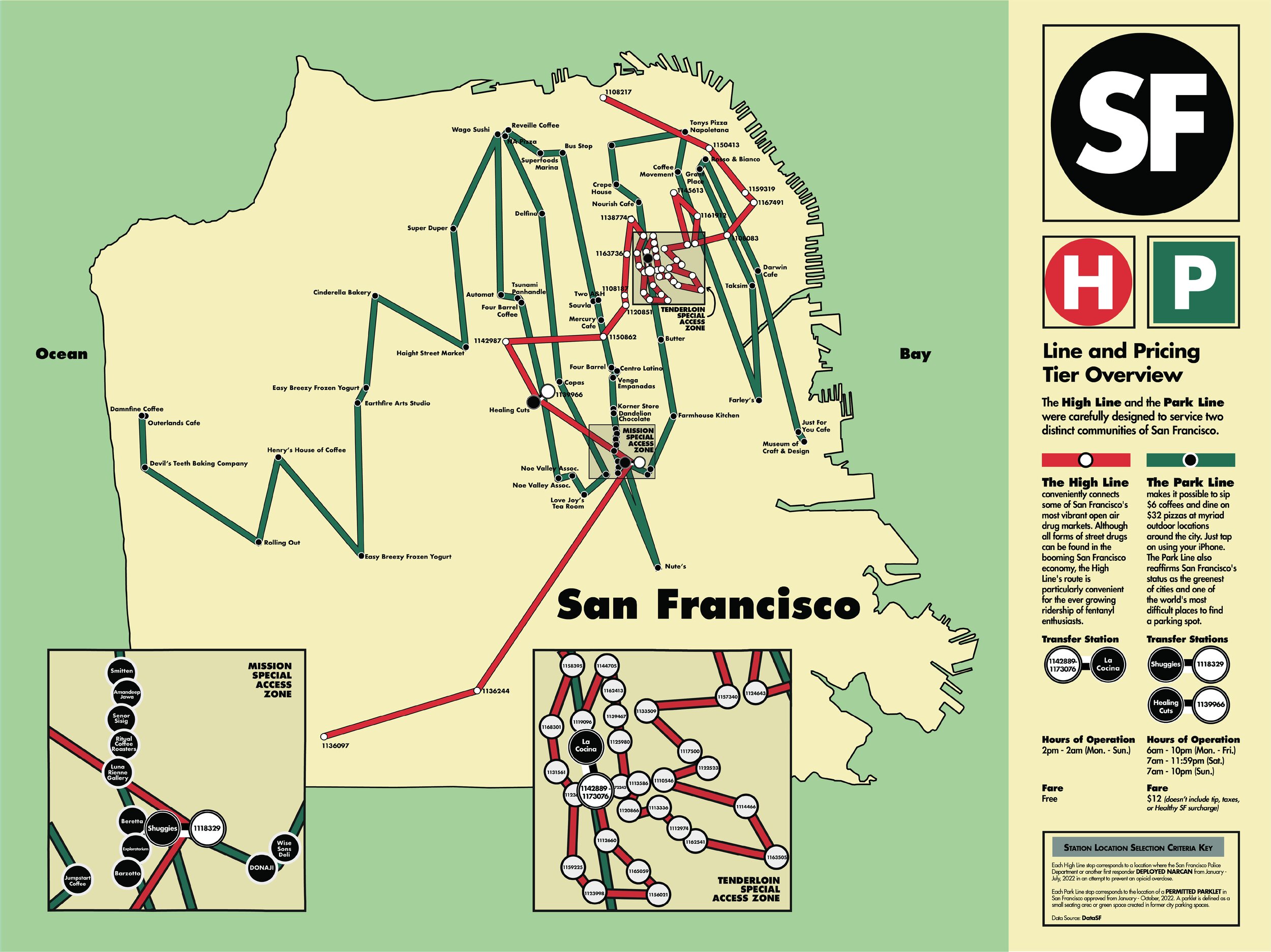
Inspired by the West Berlin / East Berlin divided U-Bahn lines prior to the fall of the Berlin Wall, this map envisions two fictional subway lines serving two very divided San Francisco communities.
Each High Line stop corresponds to an actual location where the San Francisco Police Department or another first responder deployed Narcan from January - July, 2022 in an attempt to prevent an opioid overdose.
Each Park Line stop corresponds to the location of a permitted parklet in San Francisco approved from January - October, 2022. A parklet is defined as a small seating area or green space created in former city parking spaces.
The parklet and Narcan data was obtained from DataSF, then visualized utilizing QGIS and Adobe Illustrator.

The lion’s share of overdoses necessitating Narcan usage occurred in the Tenderloin, which results in a massively over-served series of High Line subway stations in that neighborhood.

Also unsurprising, the Mission has by far the largest number of approved parklets, resulting in a parallel and equally over-served Park Line map along the Valencia Street corridor.

The contrasting Fare rates for the High Line versus the Park Line are indicative of two very different San Francisco economies uneasily coexisting in the same small city.