Huxley's Map of the World
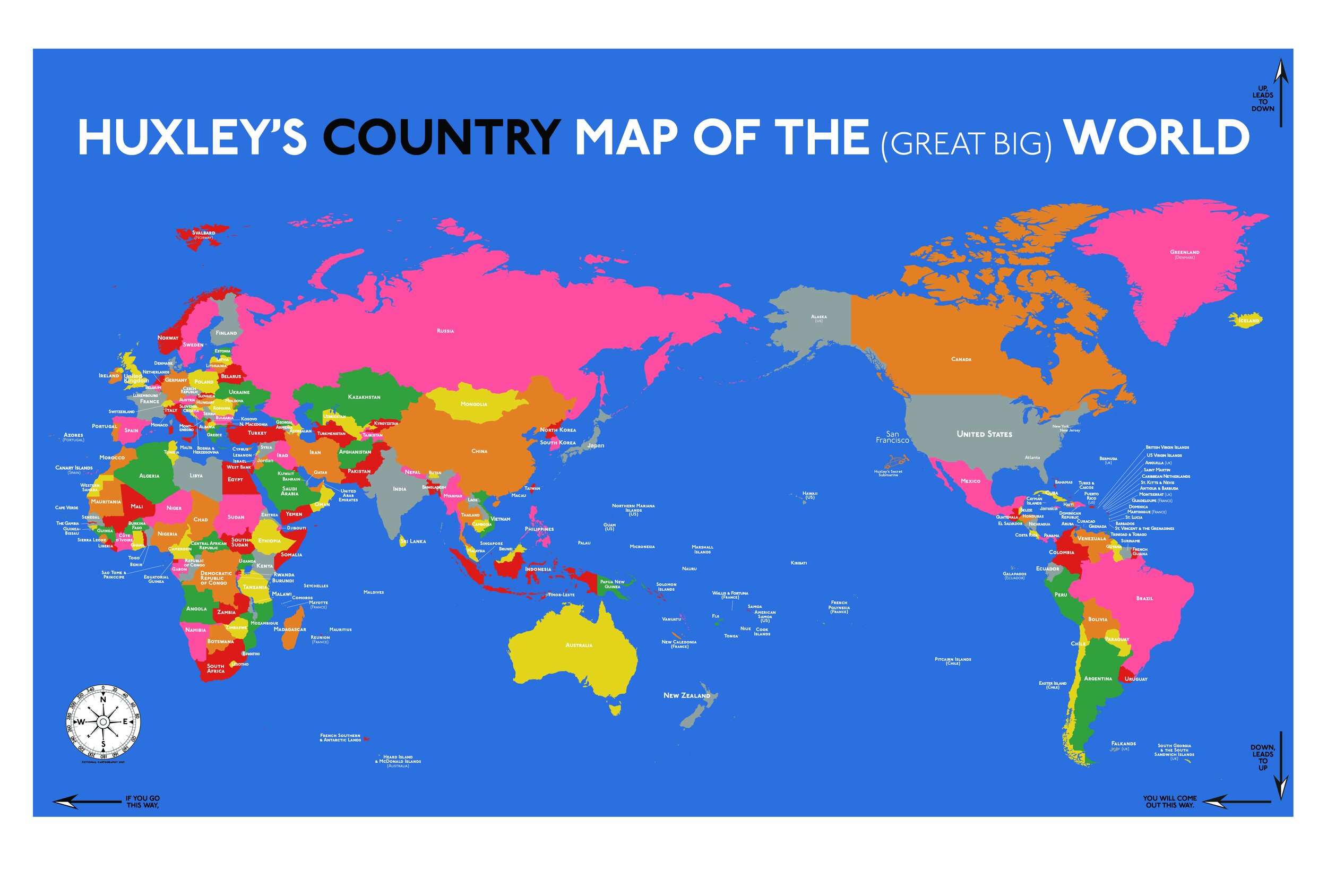
Every kid needs a map of the world. But with the quantity of questions asked by the average 4 year-old, how much detail is too much detail? With this map for my son, I tried to simplify all the way down to just the names of countries. No continents. No oceans. And just a handful of additional “need to know” places.
The backstory for this map is an intriguing world map from New Zealand, created during WWII and with New Zealand (which is almost aways relegated to the lower right corner of any world map with the Prime Meridian at its center. We bought the New Zealand map while traveling in that area of the world years ago and it has hung in my son's room since long before he was old enough to know what a map was. While the fresh perspective conveyed by this map was great, the actual countries labeled on the map started to be problematic when we realized that much of Africa still existed as various European colonies.
So I set out to create a new map which placed San Francisco at the center (or near the center) of the world and with the actual 2023 names of countries.
A major regret that I have for the map was sticking with a Mercator-esque projection that makes the Northern Hemisphere appear overly large. For reasons that are too numerous and boring to include here, my initial Southern Hemisphere friendly versions of this map resulted in a fruitless quest to hand label thousands of tiny Canadian islands in the Arctic.

A proper Africa, with the right country names circa 2023. If this map survives another 75 years, I will be curious how many of these country names remain correct?
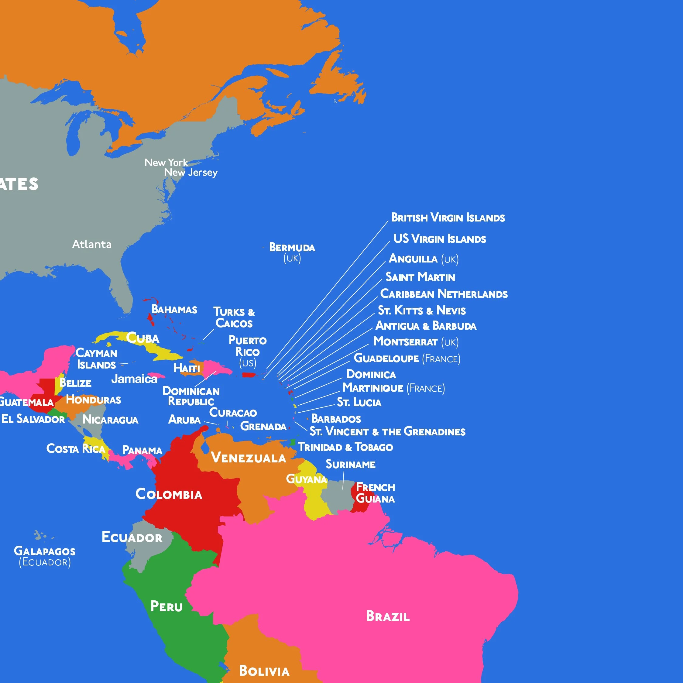
I know the historic explanation is rooted in the evils of slavery and colonialism, but the sheer quantity of tiny, tiny countries and (still existing!) colonies crammed into the Caribbean is a cartographer’s nightmare. In terms of where / how to create a country label, let’s just say it’s much more difficult to find a way to label Antigua & Barbuda (170 square miles) that the sprawling map real estate taken up by Canada.

The quantity of somewhat obscure island countries in the South Pacific is really cool. Hand labeling each of these gave me a bit of insight into what might have inspired Judith Schalansky’s fantastic Pocket Atlas of Remote Islands.